All Aboard! Conducting research at sea
We were on the research cruise for a tight, time-sensitive mission: service and deploy new transponders onto the existing benchmarks and collect data from the strainmeters and replace their modem. Our mission will involve going to three specific spots along the coast of Oregon with each of the three spots located at a different depth on the seafloor. This mission is part of a bigger mission where the scientists are trying to understand the plate boundary movement of the Cascadia Subduction Zone by recording its displacement over time and the amount of strain accommodated by this plate motion. This information will fit into our broader understanding of earthquake behavior as the two tectonic plates meet off the coast of Washington, British Columbia and (our mission site) Oregon.
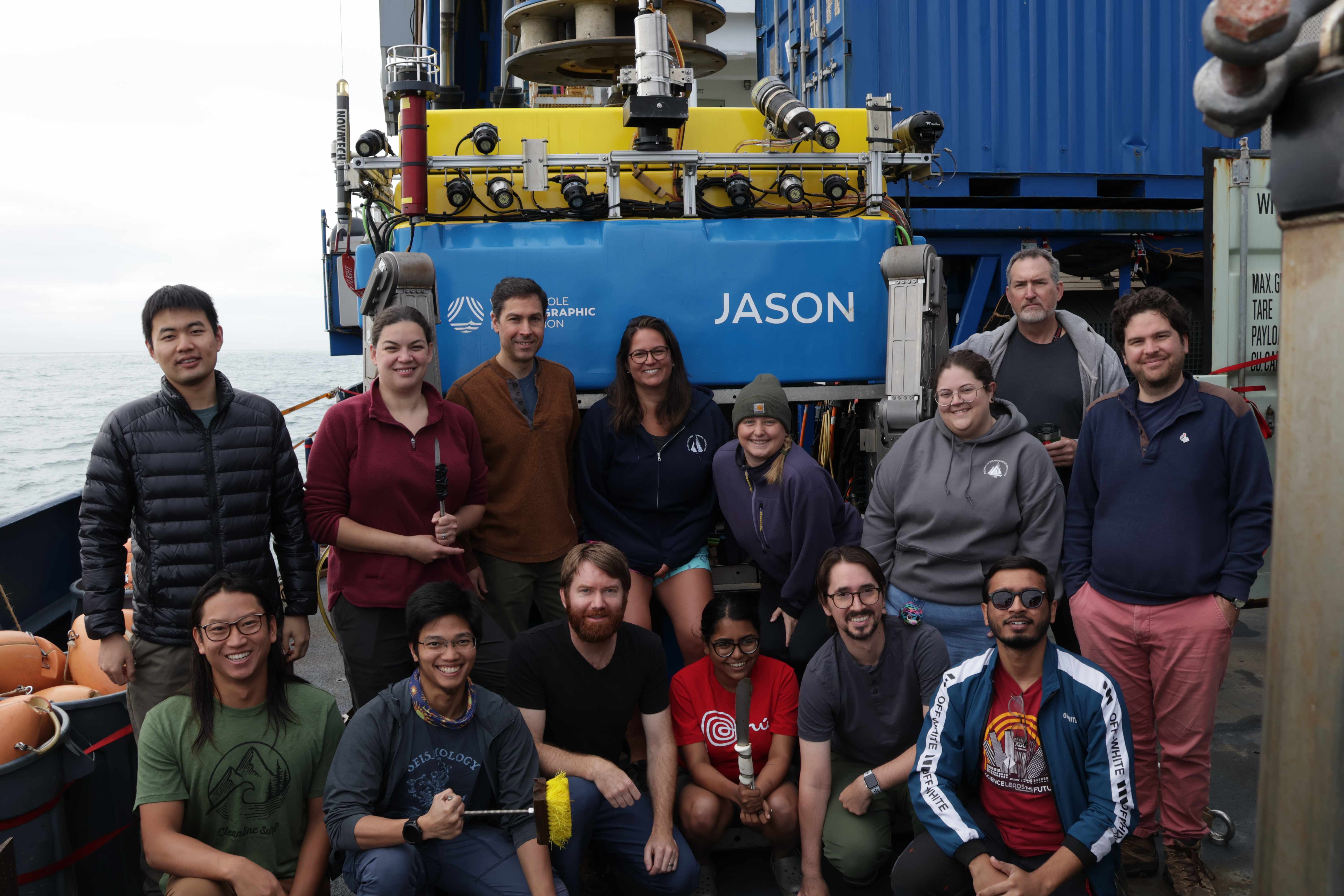 The science party for expedition AT50-27 on board R/V Atlantis. Photo credits: Angikar Roy
Starting off with the transponders. An acoustic transponder is a device that emits a different acoustic signal upon receiving an incoming signal (usually coming from a transducer). This back-forth signaling allows us to measure the precise location of the instrument relative to a reference frame (for us, the sea floor of the North American continent) by calculating the two-way travel time of the signal path. The transponder is housed within a vacuum-sealed glass sphere that is further housed within a neon orange plastic shell. We place these orange balls onto concrete benchmarks that were deployed during a previous mission. These benchmarks were placed by noting their precise location when they were deployed. We used our previously noted location coordinates to get to these benchmarks and place our transponders. For each “site”, we have three benchmarks that are arranged in a triangle. We use a triangulation method to calculate the average location of this “site”. The redundancy produced by the triangulation makes our data more accurate and corrects for any individual sub-site problems. The next part of the puzzle is the transducer: the device emitting the signal that can be located using the Global Navigation Satellite System (GNSS) satellite array as it floats on the surface. We place this on a wave glider that uses wave motion to “glide” on the surface of the water. It measures three things: the glider’s position using the GNSS system, rotation caused by wave motion, the two-way travel time between the signal emitted by the transducer on the glider and the transponder on the bottom of the seafloor.
Collectively, this combination of transponder-transducer arrays constitute the Global Navigation Satellite System-Acoustic (GNSS-A) array wherein we use a constellation of satellites to precisely locate the position of a place on earth. However, since the satellite signals cannot penetrate through water, we rely on the acoustic transponder-transducer system to do the same. The glider’s location is located using GNSS, and the back-forth acoustic (A) signal travel time is used to locate the position of the benchmark relative to the glider. The transponders are sent down to the bottom of the seafloor strapped to an “elevator”: a positively buoyant (like a floatie) platform onto which we strap the transponders and send it down to the center of our triangle. Once the transponders are taken to their respective benchmarks, the elevator floats back to the surface of the ocean and we fish it onto the ship.
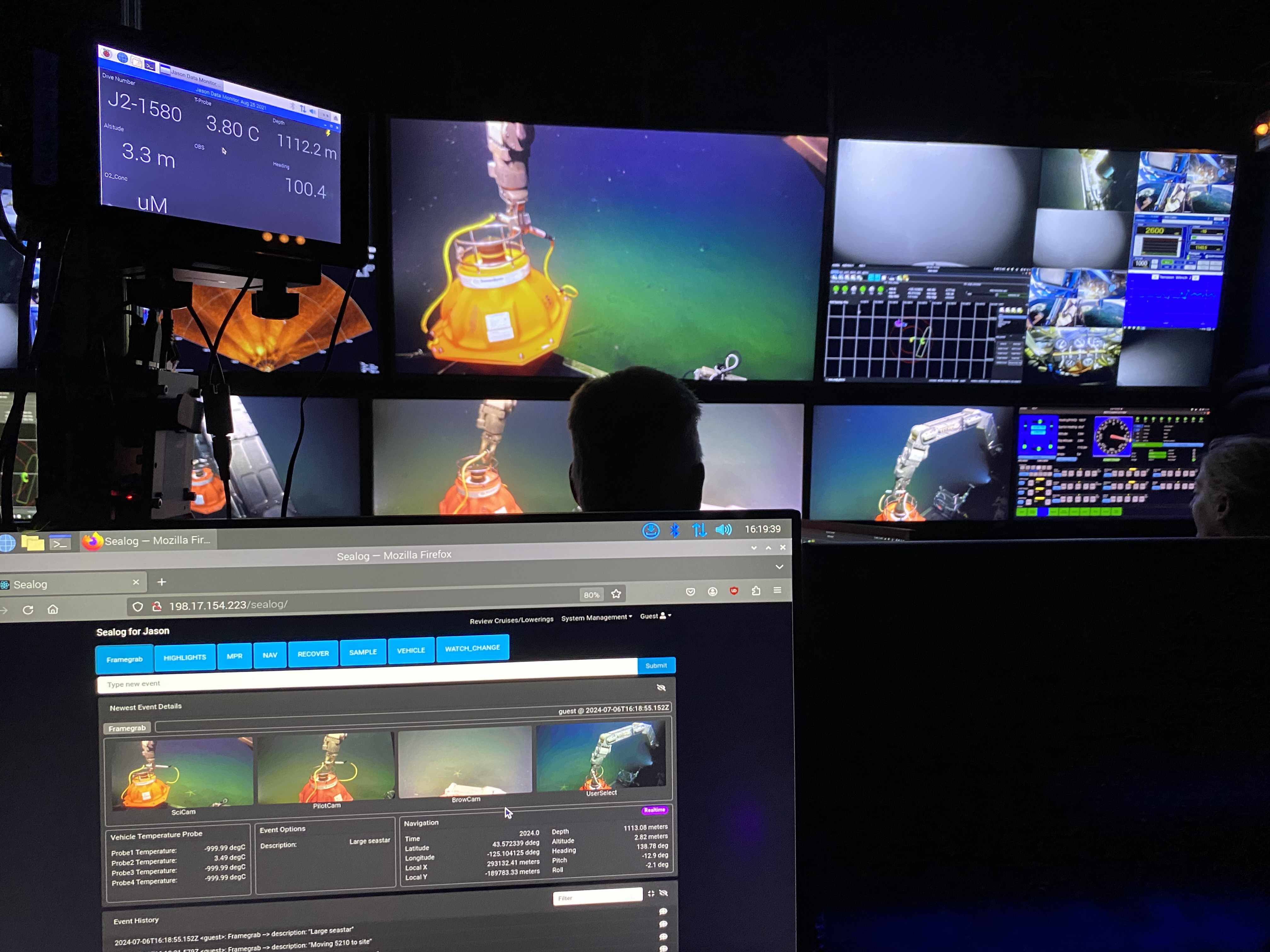 Transponders getting placed on one of the benchmarks by ROV Jason. View from Jason’s mission control. Photo credits: Jesse Hutchinson.
In order to do all this deep-sea maneuvering, we use our handy-dandy ROV Jason! Jason goes down to where the elevator is (the elevator also has a beacon so that we can locate it on the seafloor). Jason finds the elevator (thanks to our pilot who is controlling Jason’s movement from on-board the ship). Jason also carries a basket full of tools to do its job. We use Jason’s arms to grab a knife from its basket and cut one of the transponders off the elevator. Jason grabs the transponder, places it on its platform and then we go off to our benchmark location. The benchmarks are made of concrete and are usually left undisturbed. Over time, they collect a lot of sediments and deep-sea critters that make the benchmark their home. Moreover, the benchmarks also contain the rusted iron weight on it that was left behind from the previous transponder. Jason’s job at each benchmark location involves pushing the weight off, grabbing a brush from its basket and brushing the sediment and debris off the benchmark plate, and then carefully placing the transponder onto the benchmark plate. On land, these steps would not take that long. However, when we are at a depth of 2900m below sea level where ocean currents and surface wave currents can drift our ship, cause the winch system to coil around, and/or we have faulty tools that needs to be brought back up and fixed on the surface, these steps take long. One of the main waiting times for us was brushing all the sediments off the benchmark before placing the transponder on it. Since we were quite close to the coast, we had a lot of sediment input into our sites. As Jason moved about the site and brushed, it created a dust plume that completely covered our screens. So we had to patiently wait while the dust settled down before we could proceed with any further steps. Once the transponder is placed, it stays there since it has a heavy weight attached to it. It has enough battery to last for 4-5 years and once it comes to its end stages, we can send a signal to the transponder that releases the orange ball from the weight and it bobs up onto the surface, ready to be fished out. For each benchmark, Jason would go back to the elevator, cut off the straps, grab the transponder, go to the benchmark, clean it, place the transponder and repeat three times. While Jason does this (or rather before Jason operations commence), the science party also works with the technician on board the ship to do a CTD (conductivity-temperature-depth) cast. This is done to gather important information about the water profile above the site, that we use for correcting the acoustic wave signal generated by the transponder. This information might seem trivial but when we are trying to get precise location of the transponders and calculate the mm-scale of displacements, we have to correct for as many influencing factors as possible to get the best results.
The CTD is a circular array of long cylindrical water tubes that surround the conductivity measuring instrument. It is lowered into the ocean slowly by a winch system that constantly collects the conductivity and temperature of the water column with depth as it goes to the bottom of the ocean floor. Some missions also want to sample this water column. In that case, we can trigger the closures of the water bottle at precise depths so that the bottle collects the seawater from a specific depth and brings it to surface for further measurements. Some of the parameters we get from the CTD are oxygen saturation levels, salinity, and temperature profile of the water column. Depending upon the ocean currents and atmospheric conditions, these values can sway wildly.
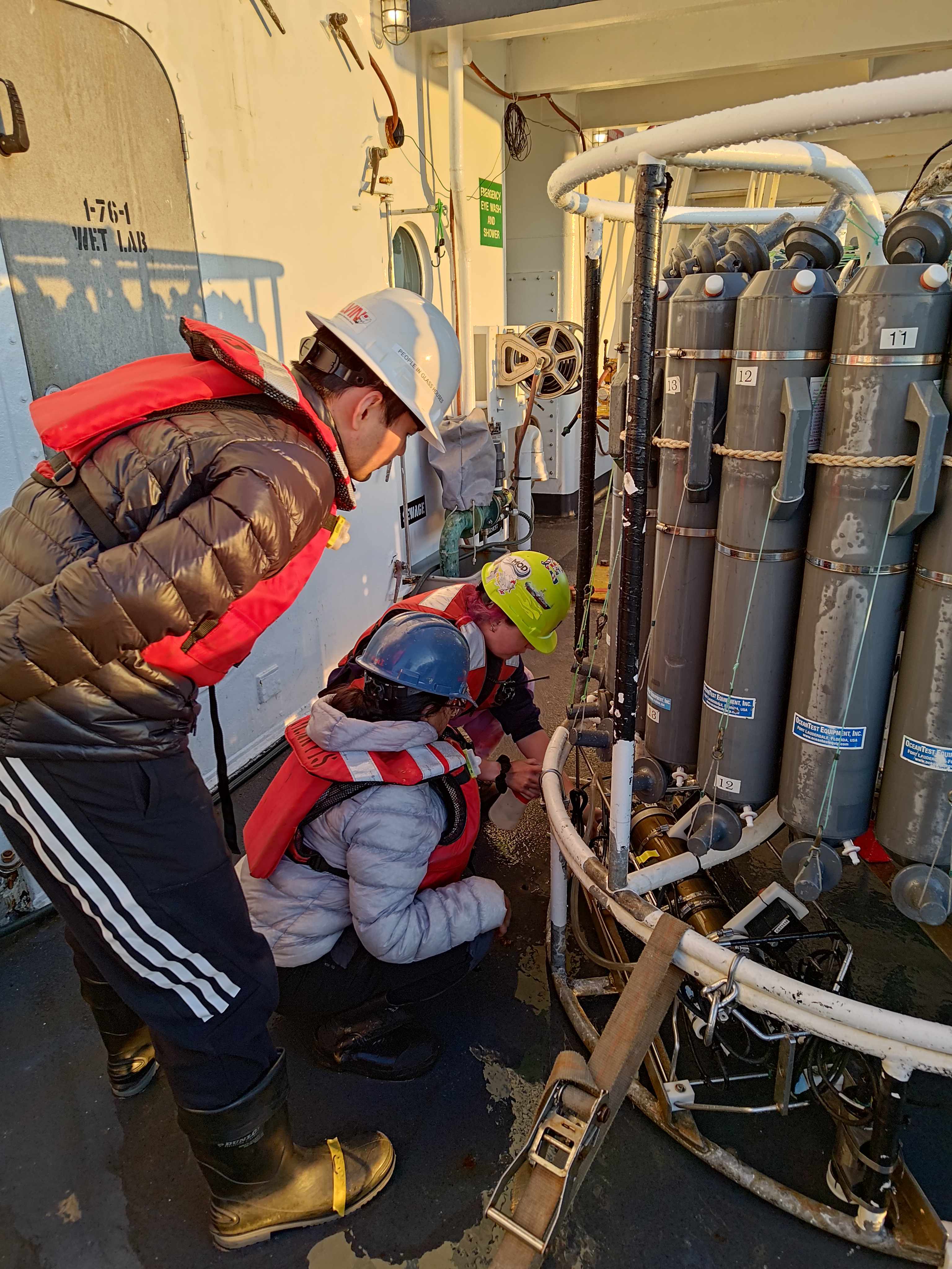 Yjie, Anna (science technician) and I are preparing the CTD for its cast. Photo credits: Raul Mendoza.
We repeated this operation at two sites off the Oregon coast. CTD followed by transponder placement and wave glider deployment. In the next post, I will talk about strainmeters (our other project goal) and a final one dedicated to our friend: Jason and what Jason saw!