
Credits: Randall Munroe, creator of xkcd webcomic
My research focuses on structural geology, around the themes of rock deformation behavior and the way it manifests across a range of observational scales. I have had the privilege of conducting fieldwork in different tectonic settings, from fold-thrust belts to subduction zones and across different depths (from shallow crusts to deep tremorgenic source depths). Here is a brief description of the projects that I had the pleasure of working on.
Subduction Sandwich: Investigating the evolution and deformation of a subduction plate boundary from the overriding to the downgoing plate
Subduction zones host some of the world’s largest earthquakes and accommodates stable aseismic sliding. In between these end spectrum behaviors, lies a transitional zone that hosts slow slip and tremor events that controls the depth at which large earthquakes can occur by transfering stress into the earthquake-producing zone. I investigated the evolution of an exhumed subduction zone (Franciscan Subduction Complex, California) by mapping a unit (Angel Island) within the subduction complex that contains rock suites that is correlated to the source region of deep slow slip and tremor. Using a combination of field mapping, microstructural analysis and geochronology, we uncovered the subduction architecture of the Angel Island unit while gaining insights about the grain-scale deformation behavior within rocks that capture the paleo-environment of deep slow slip and tremor. Find out more about the entire project in my thesis.
Other media related to this project: Podcast Interview with the good folks at Learn Real Good Podcast where I talk about my rocks, earthquakes, my research project and food!
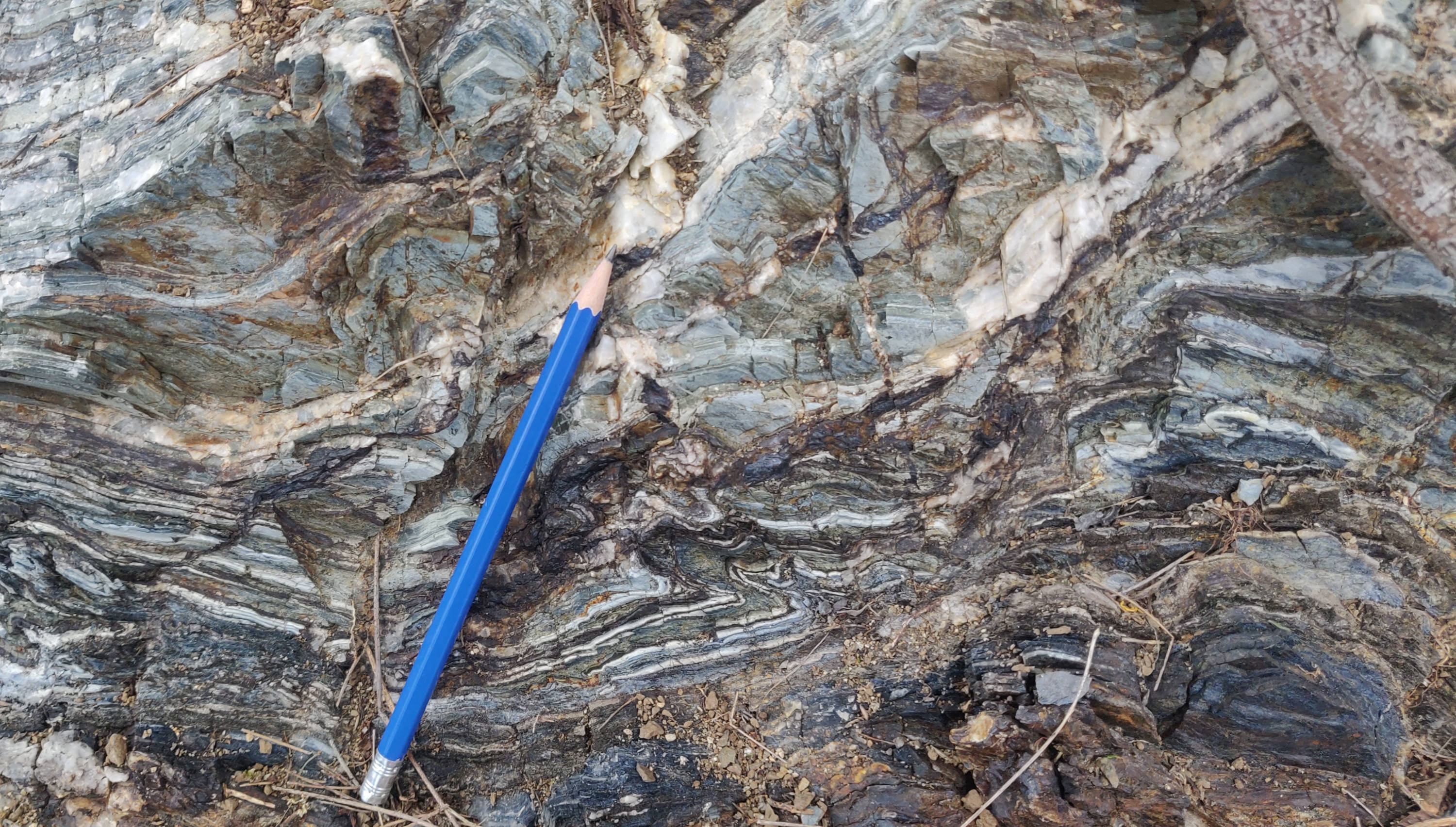 Blueschists, characterized by blue-white banding, preserved on Angel Island. The main aspect of this project involved mapping such outcrops across the Angel Island State Park in California.
Accretionary ages of subduction trench sediments
Detrital zircon grains, present within sediments, contain Uranium and Thorium elements that can be used to calculate the age of sedimentary rocks as well as gain insights about the source region of the sediments through their radioactive decay reactions. We used U-Pb detrital zircon geochronology to calculate the depositional age of the clastic rocks that incorporated into the Franciscan Subduction Complex and formed the present-day clastic stratigraphy of Angel Island. Our work revealed episodic deposition of the clastic units as well as diverse sources for the Angel Island metaclastic units with each unit tracing different stages of metamorphic history. Find out more about in Das et al., 2025 in GSA Bulletin.
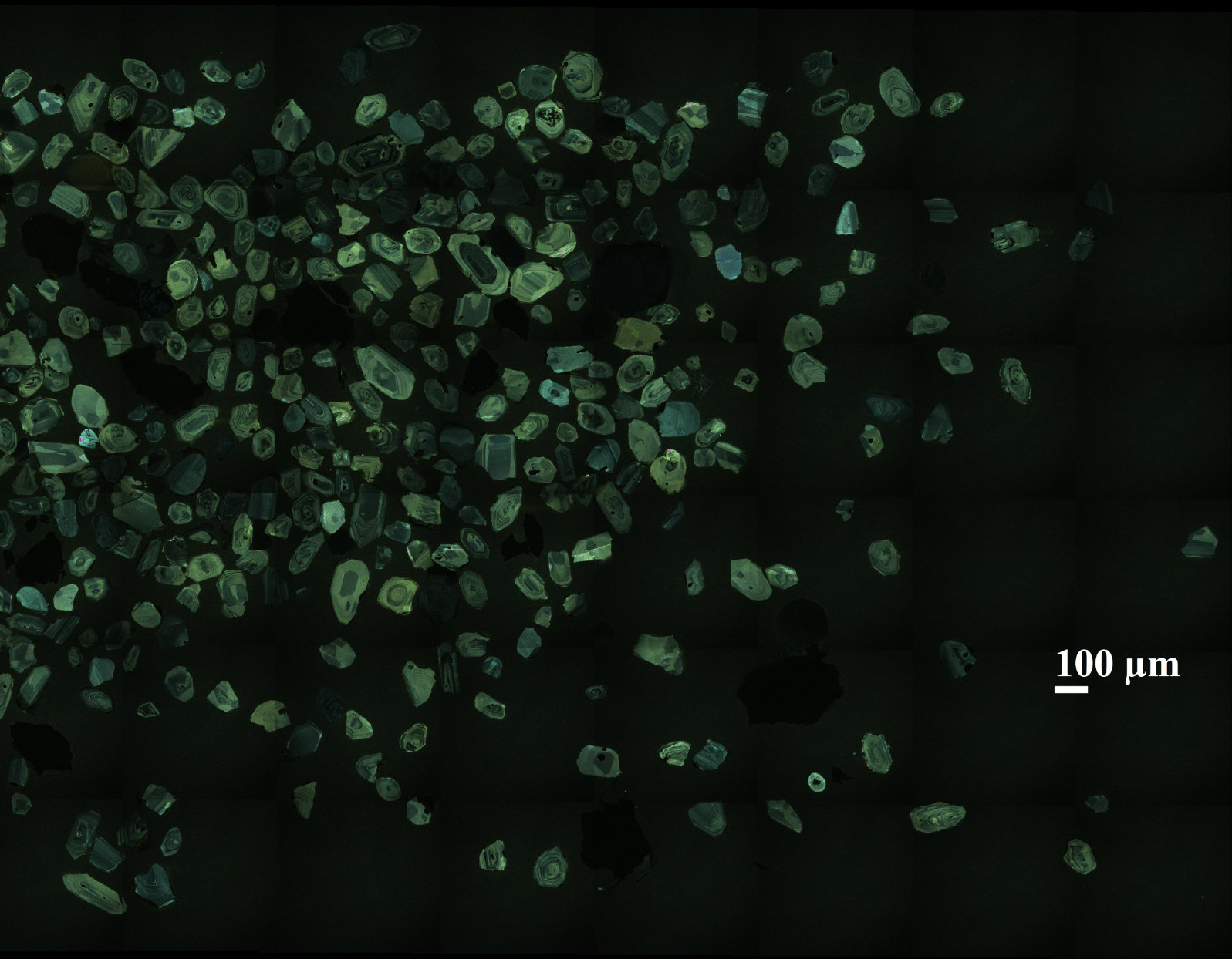 Cathodoluminescence (CL) image of zircon grains from a clastic sample mounted for analysis. CL image allows us to identify the different zones within a zircon grain and differentiate between core and rim ages.
Deformation of blueschist mylonite: Insights from Angel Island, Franciscan Complex
As subduction zones accommodates plate boundary deformation, rocks undergo high pressure-low temperature metamorphism (blueschist facies metamorphic conditions) and incorporate progressive strain as we move closer and closer to the subduction interface. We investigated the grain-scale deformation behavior of high pressure-low temperature metamorphic minerals within a blueschist mylonite along a paleo-subduction interface preserved on Angel Island. Using EBSD, we mapped the distortion within individual mineral grains as we approached the paleo-subduction interface to quantify the strain hosted within the mylonites. We identified an interplay between dislocation creep mechanism hosted within quartz and diffusive-mass transfer mechanism hosted within amphibole minerals (riebeckite and stilpnomelane) that collectively incorporated strain along the subduction interface. For more details, check out this talk presented at European Geosciences Union Annual Meeting 2023.
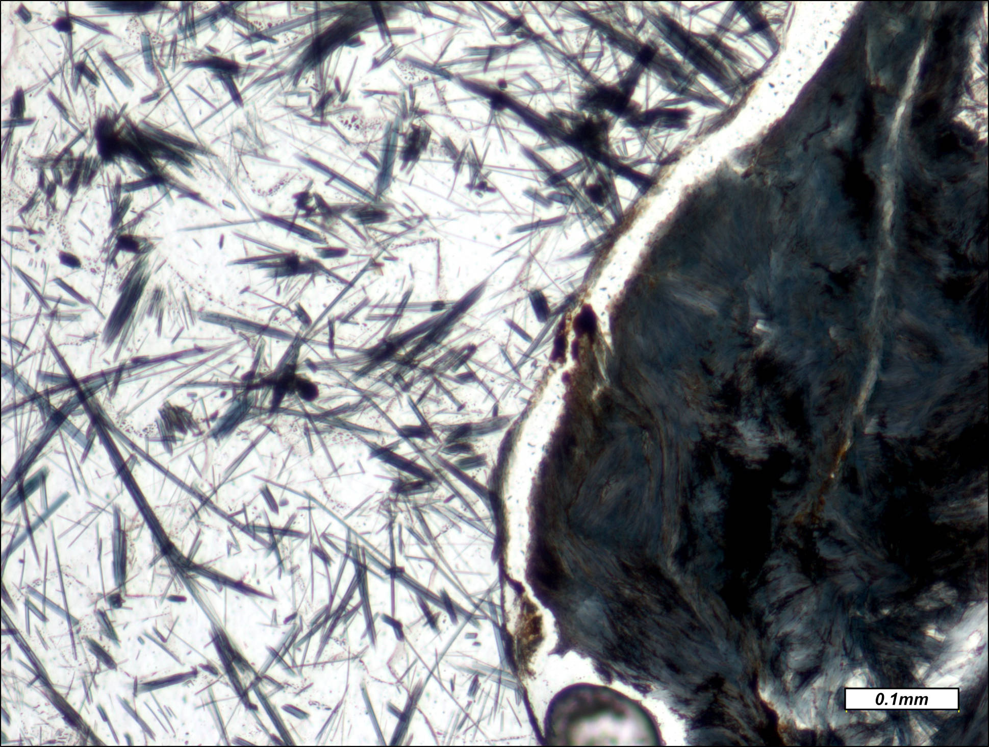 Photomicrograph of a riebeckite (common blueschist facies mineral) in a metachert from Angel Island. Presence of blueschist minerals indicates that Angel Island preserves rocks that are brought to the surface from the deeper depths of subduction zones.
Lateral Variation in the Katrol Hill Fault, Bhuj, near Gujarat, western India.
The Kutch region of Gujarat in western India was the epicentre of the 2001 Mw 7.7 Bhuj Earthquake. Kutch boasts of several fault systems that served as epicenters for historic earthquakes and displacement along these faults helped shape the current landscape of the region. One of these fault systems is called the Katrol Hill Fault (KHF), bordered by the Katrol Hill Range. My project involved mapping the KHF fault segments to determine the variation in geometry of the thrust sheet. Displacement along this fault generated a fault propagation fold (FPF) with a slight variation in orientation due to fault rotation. The fault zone rocks, mostly sandstones with variable quantities of quartz and mica grains, experienced shallow crustal deformation. We determined the strain experienced by these rocks using the Normalized Fry method along a transport parallel transect. Tha hanging wall recorded higher strain than the footwall rocks. The microstructures developed in these rocks showed evidences of brittle fracturing and cataclastic flow, suggesting deformation in an elastico-frictional regime.
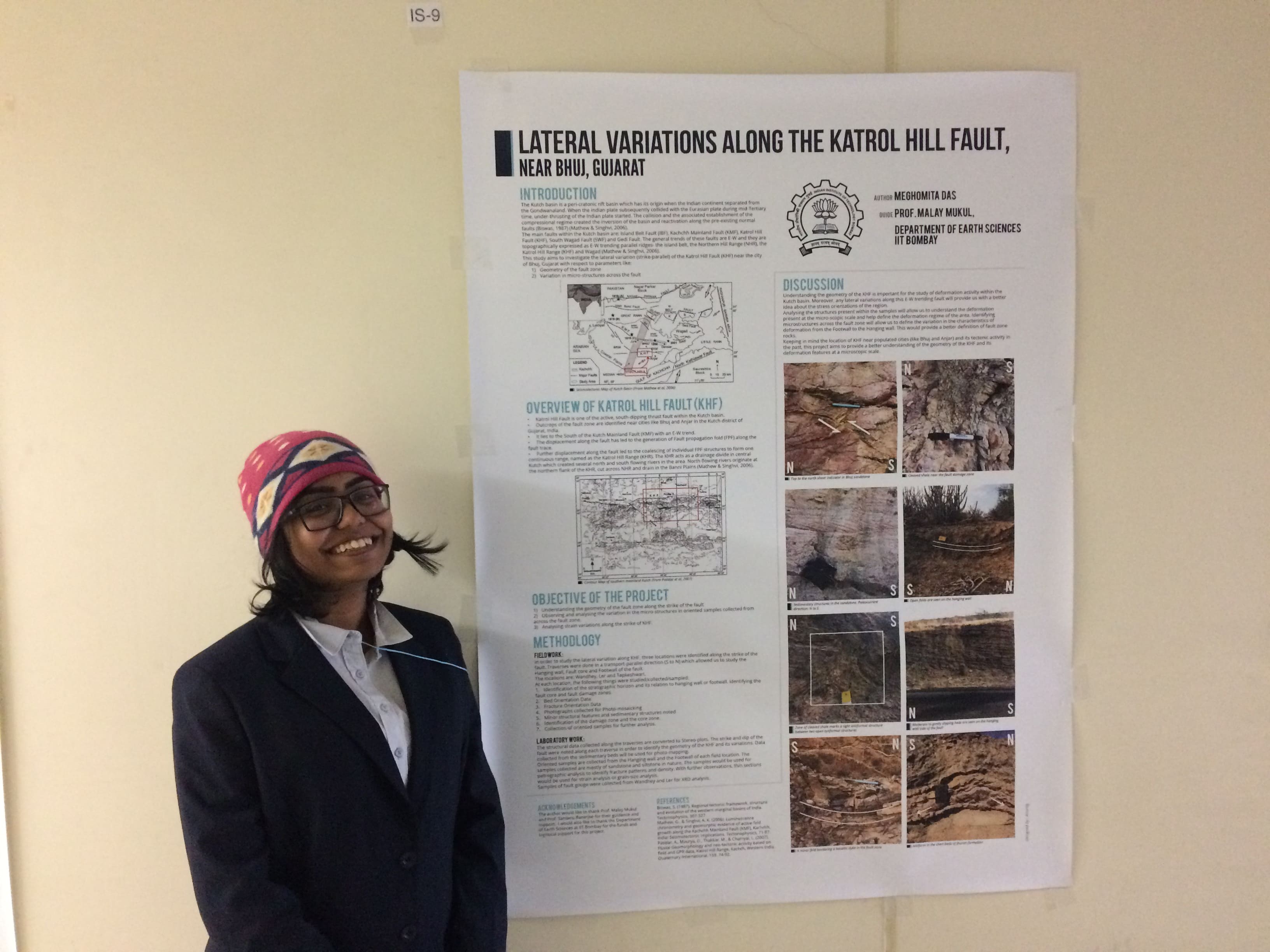 Presenting my Master’s work at the 1st International Symposium of the Hiroshima Institute of Plate Convergence Region Research at Hiroshima University, Japan.
Microstructural investigation of the Towanda Fault Zone in the Appalachian Plateau, Pennsylvania, USA.
Under the supervision of Prof Gautam Mitra, I did a minor project on the fault zone rocks of the Towanda Fault Zone. The project started with the overview of the deformation stages along the Appalachian fold thrust belt. I focused on understanding the deformation phases at the Towanda Fault Zone, in northeastern Pennsylvania. Using field and microstructural observations, we deduced 3-4 phases of deformation as preserved by structural fabrics and overprinting relationships between the fabrics. In order to identify minor cryptic fault/fracture planes, we mapped and conducted fracture density counting along a horizontal transect within the Towanda fault zone. Our study revealed that several cryptic fracture planes is present within the Towanda fault zone that allowed for strain localization and accommodated displacement within the fault zone. This project was supported by the S.N. Bose Scholars Program (2017) that allows select Indian students to pursue a funded internship project at a research institution in United States as part of India-United States of America science collaboration efforts.
Summer Internship Blog for SN Bose
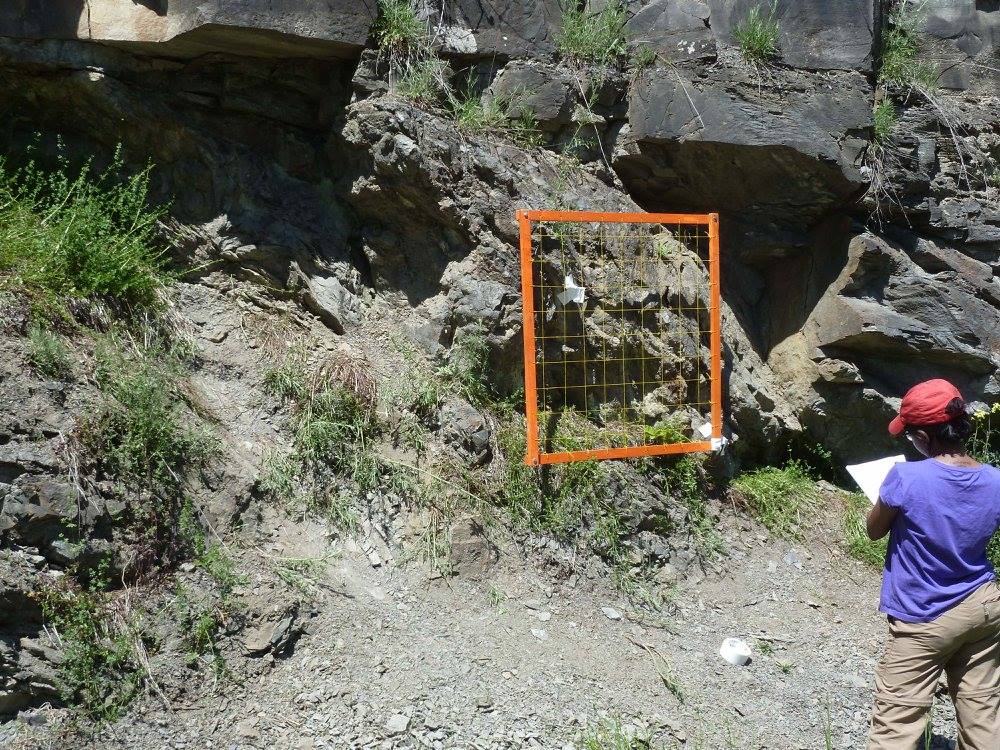
Mapping out a segment of the Towanda Fault Zone, in northeastern Pennsylvania-USA.
Optically Stimulated Luminescence (OSL) Dating : Sample processing & analysis of Quaternary sediments from the western Indian basin of Gujarat
As part of my undergraduate summer internship at the Institute of Seismological Research (ISR)-Gandhinagar (India), I did a project on using luminescence dating methods to determine the basinal uplift rate for the seismically active terrain of Gujarat in western India. I was mentored by Dr M.R. Kumar and Dr. Siddharth Prizomvala for this project. OSL dating provides reliable ages, especially for the age range where the radiocarbon dating methods are not feasible. I got an overview of the entire process of OSL dating from sample collection to data processing and analysis. I worked on quaternary sediments and terrace deposits accumulated along river basins that are cross-cut by active faults to determine uplift rates. In combination with sedimentological characteristics of the samples, I reconstructed the paleo-depositional and paleo-seismological history of one of the river basins in Gujarat. This project added on to the growing data base of paleoseismological uplift rates of the tectonically active Gujarat basin of India.
Land Acknowledgment
McGill University is based in Tiohtiá:ke/Montreal, the traditional and unceded territory of the Kanien’keha:ka (Mohawk) - a place which has long served as a site of meeting and exchange amongst many First Nations including the Kanien’kehá:ka of the Haudenosaunee Confederacy (also referred to as the Iroquois or Six Nations Confederacy), Huron/Wendat, Abenaki, and Anishinaabeg. At present, I am based in Thunder Bay, Ontario, on the land of the Anishnawbe people and the Treaty territory of the Fort William First Nations. As a field-based researcher, I am constantly working on lands that belong to Indigenous nations. At Angel Island-California, I am working on the lands of Coast Miwok, Muwekma-Ohlone, and Graton Rancheria nations. At Towanda-Pennsylvania, I worked on the lands of Haudenosaunee Confederacy and Susquehannock nation. At Kutch-India, I worked on the lands of several Kutch tribes, namely: Rabari, Ahir, Jats, Harijans, Sodha, Mutwa, and Node. I acknowledge and thank the nations whose lands I got the opportunity to work on. References: Native Lands and Tribes of Kutch